Tuesday, September 29, 2015

Southbound On The West Coast - Sensational, Wondrous, Dazzling.

To celebrate the beautiful northwest, listen to this recording of 
Woody Guthrie's song, Roll On Columbia,  recorded by 
Dave Mallett and The Mallett Brothers. 
It's now the official folk song of the state of Washington.

Wednesday, September 23, 2015

We left Poulsbo and the family and headed south. It took us a while but we reached the famous U.S. 101 - part of a collection of roads designated as the Pacific Coast Highway. which runs from the most northwesterly point of the United States up yonder on the Olympic peninsula to the southern tip of Baja California. And it passes through an interesting and varied coastline with hilly terrain and some of the most spectacular scenery imaginable: the vast and endless beauty of the seething Pacific ocean, giant rocky monoliths that jut up out of the sea floor, often shrouded in fog, wide and empty sand beaches that stretch on for miles and the grandeur of the redwood giants, some of which have inhabited this earth for as long as a thousand years. Seeing them is a humbling experience if there ever was one. There are quaint villages  to explore and twisty roads to drive on, making it difficult to gaze out at the impossible vistas that greet you at every turn. Thankfully, there are innumerable turnouts that afford a place to just rest and look and think about the beauty of this country of ours.

Crossing the Columbia river on the Astoria-Megler bridge from
Washington to Oregon. The city of Astoria, Oregon is on the far bank.
Just around the bend in the river here is where Louis and Clark g
ot their first view of the Pacific ocean.

We stopped for lunch in Astoria on the banks of the Columbia. These sea lions were cavorting
and barking loudly as they swam  up and down the harbor. 

Quite beautiful: the Columbia River as it flows out to the Pacific.
At this point it is five miles wide. This is the point where
Louis and Clark completed their historic explorative journey.
But they had to pause a few days, waiting for the turbulent wind and waters
o calm before they could view the Pacific ocean.

Astoria, like many of these western towns, has been able to reinvent itself to some extent. This is a proces we'd seen repeated in many of the cities and town that we passed through. As industry dried up, in this case logging and fishing, tourism takes its place. Or at least that's the idea. Towns have reclaimed and restored their old historic main streets, repurposing buildings to house shops and restaurants and other businesses. Sometimes it works; often it doesn't or it's a work in progress. We saw  success though in Idaho Falls, Walla Walla and now Astoria, Oregon.

City wastebaskets have reproductions of old
salmon cans emblazoned on them.


This old art deco building is now a restaurant.

They built incredibly beautiful and ornate theaters in many
of these western towns. Impressive!

Astoria street corner and historic buildings.

Another waste basket: Gill Netters Best.

We drove on to our evening's stopping point: Cannon Beach with its famous Haystack Rock, a massive rock that juts up from the ocean floor. It's surrounded by other monoliths and provides a stunning vista of churning ocean that constantly pounds the rocks, sand beach and, by comparison, tiny humans walking on this vast and sweeping expanse of beach.


Our hotel, the Wayside Inn, was right across the road from the beach.
Great location and lovely hotel. Pet friendly too!

We walked on the beach as the sun was peeking out from the
bottom of these clouds, creating a dramatic sunset.

Biggie finally gets a chance to chase a ball
after being cooped up in the car all day.

Canon Beach and its famous Haystack Rock. You can't realize just how large it is until you
see people standing next to it in the distance -- they're tiny  by comparison and then you  suddenly
appreciate the massive size of this outcropping. It towers 235 feet above the beach.

Cannon Beach - the sun set after it peeked out from under this cloud-laden sky.

Spectacular Cannon Beach.


CLICK FOR A LARGER VIEW
A panorama of Cannon Beach at sunset.

Tomorrow we'd continue along this amazing highway, stopping in Coos Bay, Oregon and the next night in Arcata, California.

Check back for more of our road trip.    - Matt


Monday, September 28, 2015

With The Family ...
In Poulsbo (pronounced PAULsbo)

Wednesday, September 23, 2015

The last leg of the westward part of our cross country road trip delivered us to familiar surroundings, not to mention family, in Poulsbo, Washington. That town is on Liberty Bay which is an arm of Puget Sound and lies on Kitsap island directly across the sound from Seattle. It was founded by Norwegian immigrants in the 1880s who replaced the native Suquamish people who inhabited the shores along Liberty Bay for some 5,000 years, hunting, fishing and collecting shellfish in the waters of their shoreline.

Poulsbo  is pronounced Paulsbo. But why? Not some regional pronunciation, but, as the story goes, the fault lay in illegible handwriting. Early residents, naming the town after one in Norway from whence they emigrated, wanted a post office for their new village and registered the name with Washington, DC. Some bureaucrat there misread the application, mistaking the "a" in Paulsbo for an "o." It was never corrected and remains that way today. Except, of course, for the pronunciation which remains decidedly PAULsbo.

CLICK TO SEE A LARGER IMAGE
Poulsbo is in the upper left on the Kitsap Peninsula.
It's lies across Puget Sound from Seattle.

Dani and Erik, along with our grandsons, Sammy and Ethan, live a ways outside of town in a lovely house with a huge backyard . The house fronts on a quiet cul-de-sac that provides lots of room and a safe place to play, ride their bikes and scooters and hang out with friends on the block.

Ethan rides his bike on a safe cul-de-sac in
front of his house.

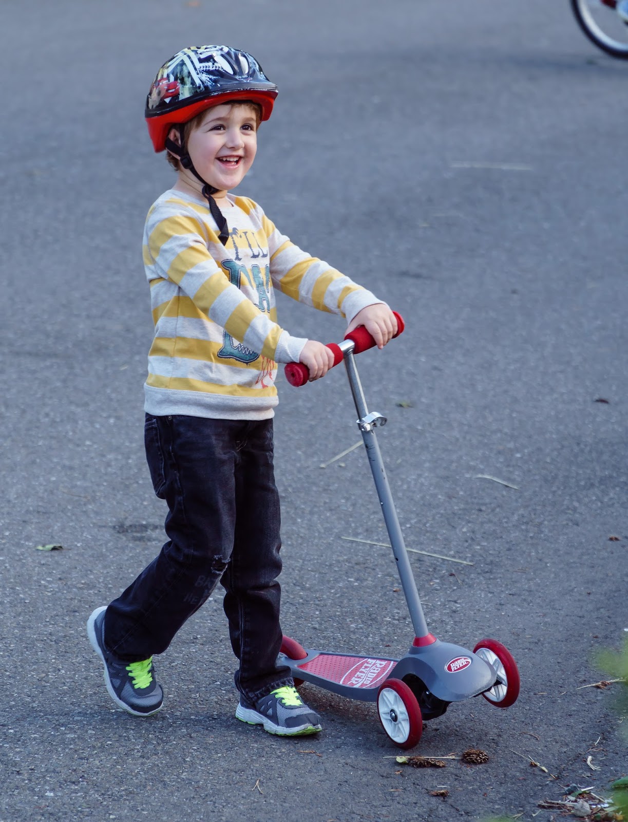
My sweet grandson Sammy on his scooter.

We arrived in Poulsbo on Thursday, September 17th and stayed for six days of fun and family. There were lots of good times - just hanging out, enjoying some good home-cooked meals, visiting some local towns and spending the day at the Washington State Fair. Stacey and I also got to spend a day on our own in Seattle, taking the ferry in and out (a wonderful trip in and of itself) for lunch in that city's Chinatown and a trip to the Ballard Locks.

On Saturday we visited a neighboring town of Gig Harbor to see Dani's photograph that was on display in a juried exhibition at the museum there. A nautical fair was taking place as we got there so we perused the crafts as well.

Dani and her juried  photograph on exhbiti in the museum in Gig Harbor.


"Solitary" the beautiful photo by my daugher.


Sammy climbs out of a fish's mouth on
display at the Nautical Fair in Gigs Harbor.


Ethan slides out of the mouth of a fish.

The ham family....hamming it up.

The next day, Sunday—we took a drive to Puyallup (pronounced Pyu-AL-up), a town near Tacoma at the southern end of Puget Sound, named for the native people who used to inhabit the valley surrounding the present day city. The name means "generous people." Perhaps they were a bit too generous and welcoming as they were soon overwhelmed by settlers and eventually forced on to reservations. To this day the grave injustice  of this ethnic cleansing has never been righted.  More of this sad history can be found on the tribe's website here.

Puyallup is also the sight of the annual Washington State Fair which is the state's largest single attraction and lasts17 days each September. I'm not one for these kind of events but it turned out to be a fun day for all of us. My favorite part? The livestock displays: cows, llamas, alpacas, pigs and more, tended to with love and expertise by farmers and their families.

Welcome to the Washington State Fair!

State Fair entertainment dudes.

Curiosity.


Let's see how this contraption works.


Kissy kissy.

Sammy tries to ring a rubber ducky and
win a prize.

Ethan whacs-a-mole.


Stacey's getting a little carried away on the bumper cars as Ethan seems to be wondering if he's in good hands.


Lots of fun at the Washington State Fair!

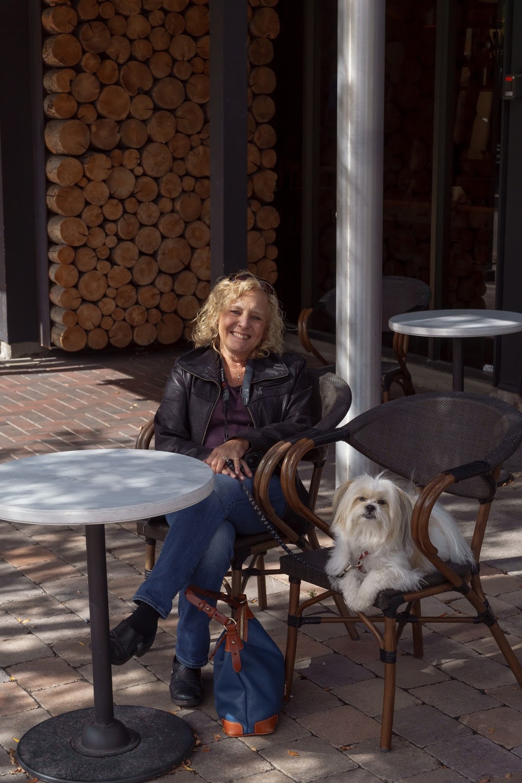
On another day, while the kids were in school, Stacey, Dani and I drove over to the pretty little town of Bainbridge (that's where one catches the ferry to Seattle) for a walk around, some shopping and a light lunch. It was a nice day and the town and the island of the same name that surrounds it has a great ambiance with lots to offer: beautiful parks with hiking trails, galleries, restaurants, shops and cafes. All these make it a good destination.

Dani and Stacey in Bainbridge.

The sign says it all - a nice place to visit and also the ferry to Seattle.

Stacey and I would spend one more day in Poulsbo before heading down the Pacific Coast Highway that meanders along the Wasington, Oregon and California coasts. On Tuesday we drove to nearby Bainbridge once again, but this time to take the ferry to Seattle.

Seattle is surrounded by water. They do a great job getting people
around with an efficient and inexpensive system of powerful
and comfortable feries.

Sail away - we're heading from Bainbridge to Seattle. 

We'd have lunch in the International District which is home to the city's Chinese restaurants. We followed that with espresso and a really great donut at Top Pot  Donuts, housed in a repurposed deco building.

A lunch of oysters with toasted garlic at
Harbor City, a Chinese restaurant in
Seattle's International District.

My roast pork wonton soup. Yes!


For desesrt - Top Pot Donuts on Fifth Avenue just north of downtown Seattle.

Retro  digs for donuts at Top Pot.
After our donut dessert we drove to a Seattle attraction that we've been to once before: the Chittenden Locks. Located in what used to be a hardscrabble blue collar neighborhood of light industry, docks and warehouses, Ballard is now a hip and funky place with lots of cute shops, restaurants and bars - a fun place to explore. But, I wondered, what happened to all the workers who used to reside here? Driven out by increased property values? The same phenomenon everywhere we go.

The Ballard Locks, as they are also called, are an engineering marvel built in 1917. They are the most heavily used locks in the U.S. and carry the name of the engineer who designed them: Hiram M. Chittenden. They perform the task of connecting Puget Sound at sea level to the much higher Lake Washington to the east of the city. What was non-navigable before the locks were built, is now an easy passage for pleasure boats and ocean-going freighters and fishing boats. Lake Washington was an important logging port because it lay at the foot of the Cascade mountains but getting the products from its shores to the port of Seattle for destinations down the west coast was a very difficult matter.  

We returned a second time because the process is fascinating to watch. As boats come in from the Sound or depart for it, the process of raising or lowering them inside the lock's chambers grabs and holds your attention. This is one of Seattle's biggest attractions, attracting over a million people a year.

An interesting sideshow: Salmon once spawned in the streams and creeks that flowed out of Lake Washington. With the building of the locks they'd be blocked from returning to their spawning waters to lay their eggs. Chittenden realized the problem and built a fish ladder that allowed them to bypass the locks and dam that were being built. An added bonus: underwater viewing windows so we humans could watch the fish as they made their way up stream. We were off season for viewing salmon last time we visited. Not so this time.

Here come some boats. Lots of spectators,
including this group of visiting Japanese high school students from Tokyo.
There are two sets of locks. This is the smaller, purpose-built for small
pleasure craft. The other one serves large ocean-going vessels.

After the boats enter the lock, the gate closes behind them,
the boats tie up to a sliding wall that rises with the water that's pumped
in to bring them up to the level of inland Lake Washington, east of Seattle.

Going up! Notice that the back gate is now closed and the level behind it is much lower.
When the level is equal to the water beyond the front gate (i.e. equal to the water level in Lake Washington) the front gate will open and the boats will get under way. Cool! The bridge visible in the back is a reailroad bridge
that's kept open until needed.

CLICK TO SE LARGER
A sign explains how the fish ladder works.

Salmon swimming up toward Lake Washington courtesy of the fish ladder.
We get to see them thanks to these underwater viewing windows. Cool!

Look baby....a fish!

As always, our days seem shorter than the amount of time needed for our explorations. It was getting late. So we left the locks, having wanted to explore the adjacent Seattle Botanic Gardens as well. That will have to wait for another visit. We headed back to the ferry terminal for our trip across the Sound to Poulsbo and family. A memorable day! Tomorrow we'd leave for our journey south along the beautiful coasts of Washington, Oregon and California. Check that out...in my next post. (Brooklyn, we miss you!)

Heading back via ferry across Puget Sound.
This is always a breathtaking sight: solitary Mt. Rainier with snow on top.
A daytime moon is visible also. What a ferry ride this is!


A beautiful vista: Puget Sound, the island of Bainbridge and the Olympic
Mountains greet your view as we return home from a day in Seattle.

Tomorrow - on the road again.
Heading south along the west coast on the beautiful U.S. 101, aka
The Pacific Coast Highway. See you on the road!

Wednesday, September 23, 2015

Good bye Idaho.
Hello Hello, Walla Walla!


Wednesday, September 16, 2015

Another long day of driving - 391 miles from Hailey, Idaho to Walla Walla, Washington. We were heading to the west coast and family: Dani and Erik and the grandsons, Sammy and Ethan.

We started the day in Sun Valley, the upscale ski resort. People call it Sun Valley but the actual town is Ketchum, Idaho and it's a very pleasant and comfortable place, catering to wealthy people, we judged, observing the kind of stores and the type and prices of goods they were selling. Our hotel was in Hailey, some 17 miles south of Ketchum.  We had no reason to see Ketchum except for the fact that we have friends and neighbors around the corner in Brooklyn: Robin and Peter Ketchum. We thought it would be cute if we could bring them something with their name on it. So instead of heading back south to US 20 we headed north. We'd have to double back south after our look around in town.

CLICK FOR A LARGER VIEW
Map of today's drive -291 miles from Hailey, Idaho to Walla Walla, Washington.

We walked around the town a bit, popped in and out of some of the shops, had an espresso at a cafe, picked up some sandwiches for a picnic and then headed down to US 20 again to continue our westward journey. That road, which we'd been travelling on for the last few days, connected to Interstate 84 which trended northwest, clipping a triangle out of Northeastern Oregon and, much later that day, entered Washington where we stopped for the night in the city of Walla Walla.

The view that greeted us in the morning as we walked out of our motel
in Hailey, Idaho which is situated in Sun Valley.

Irving's hot dog stand in Ketchum, Idaho.
(Sony Alpha illustration mode for a painterly effect).

No parking any time. (except for log deliveries).

Stacey and Biggie at a cafe in Ketchum, Idaho,
a sweet little ski town.

Ketchum is an upscale ski town with lovely and pricey shops. It's surrounded by the mountains that
tower over Sun Valley.

We didn't realize it earlier but we had been tracing the same westbound passage that Lewis and Clark had explored in the early part of the nineteenth century, under orders from President Jefferson to find a northwest passage to the Pacific that would increase commerce and settling: American expansionism. After their amazing and terribly difficult adventure, easier routes were discovered that made wagon traffic possible. These routes to the west became known as the Oregon Trail and as the years passed were used by as many as 400,000 settlers, ranchers, farmers and miners as they headed west looking for land, wealth and new lives on the frontier.

High up in Idaho, a view across the valley that was used as a shortcut
to avoid hostile indigenous tribes. Natives, rightly fearing for their homes and lands,
were attacking invading settlers.along the regular Oregon trail to the south. The
shortcut came to knowsn as Goodale's Cutoff.

Sign confirms that we've been following the trails of early and  mid-nineteenth
century emigrants as they made their way across the land, heading west
to seek fortune and land. This "cutoff" was a shortcut used to avoid
indigenous warriors who attacked the invading settlers who would take
their homes and lands.

We cut a snip out of the northeastern corner of Oregon and headed
up to Walla Walla for a deserved rest after a day of driving 300 miles!

It was too late (and we were too tired) to start looking for a place to eat. So we feasted on corn chip and almonds from our snack bag. When we woke after a good night's sleep at a Red Lyon motel, I discovered that one of the few late night haunts that were presented as dining choices was right across the street.  Not only that, but were on the edge of the city's historic restoration district. So off we went for a little walk downtown. Walla Walla is the friendliest little city in America. So said USA Today. And it is little with a population of just over 31,000. It also won an award for having transformed  and preserved its dilapidated Main Street into a lovely and thriving thoroughfare. With that we can agree. Lined with shops, winery outlets and restaurants, we found it very inviting. Residents are fond of saying they liked their city so much that its founders named it twice. But the name Walla Walla acdtually is an indigenous name meaning "many waters."


I tied Biggie to this street sculpture so I could take his picture.
But before that he had been barking at it. 

Wineries have set up shops on Main Street in Walla Walla.
This  is, after all, Washington's wine country - the Columbia
River valley.

Lovely preserved old buildings line the city's restored historic district.

A beautiful old theater. Now, unbelievably, it's a Macy's department store.
But at least the exterior has been preserved. Spectacular.

Detail on the America Theater in Walla Walla.
We left Walla Walla and continued toward Poulsbo and the family. This southeast section of Washington was desert until we crossed the Columbia River and crossed into Washington's beautiful and fertile wine country.

Again, thousands of wind turbines outside of Walla Walla on the arrid hills of eastern Washington's high desert.

Wine country? Well, then you gotta try some of our wine, right?
We stopped at the Fourteen Hands  winery. They sell 3 million cases a year!
We bought 3 bottles.


Biggie doesn't drink wine but he was welcome at Fourteen Hands winery anyway.

At the tasting room picking our selections to sample.

He's a good dog and well-behaved. Why we love him so much.
Just a few hours more and we arrived in Poulsbo where we were greeted by Dani, Erik and our two grandsons, Sammy and Ethan. We'd spend five days and then head on down the coast to our friends in the wine country of California, Ann and Alex. Oh....more wine! Yes! But that story is yet to be written.   - Matt